Weather service: Wind, cold coming today, snow possible Thursday
Our area, as well as the rest of central and northern Indiana, is under a wind advisory according to the National Weather Service. You can expect strong winds late this morning and early afternoon with some gusts of up to 40 mph. The advisory is in effect until 6 p.m. this evening.
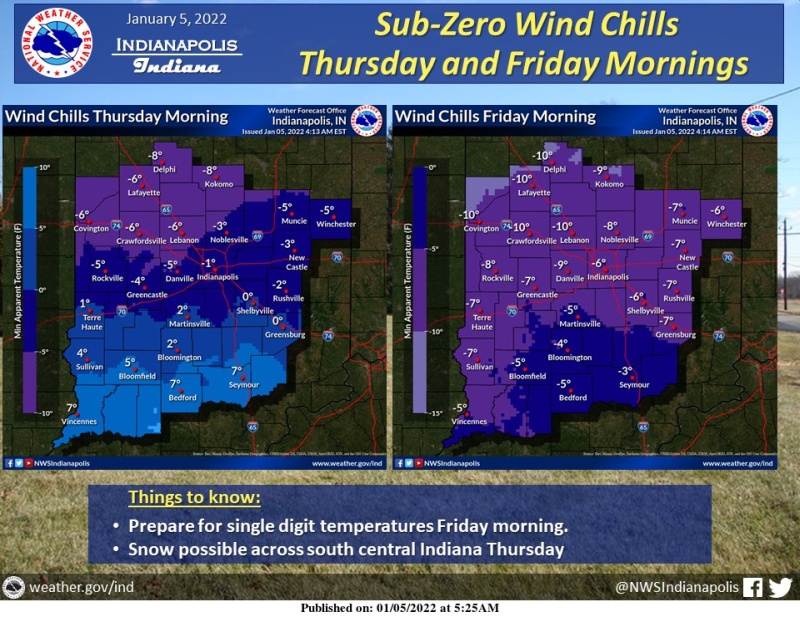
The weather service says that southern Indiana is at the greatest risk in the state for snow accumulations from cold weather coming through on Thursday. The agency shows Seymour at the north center of a band stretching across the southeastern part of the state with a 60 percent plus percentage chance of 1 inch or more of snow.
That will be coupled with the lowest temperatures we have seen this season, with wind chill levels of zero or below by Thursday night.
Bartholomew County Emergency Management suggests that you take extra time to travel, be careful of slick roadways and dress in layers to keep warm during the cold snap.