
Severe storms threaten much of southern Indiana tonight
Damaging winds, hail, heavy rain, and isolated tornadoes could be moving through central and southern Indiana tonight. And we could see record-high temperatures for early December today.
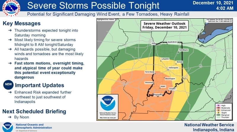
In an update this morning, The National Weather Service Storm Prediction Center
now has all of southwestern and south central Indiana under an “enhanced” risk from a line that stretches roughly from Terre Haute and Bloomington through Corydon. That includes parts of Bartholomew, Brown and all of Jackson County. That means the center is confident that widespread storms will develop, and that these storms are capable of causing significant damage.
Highs in southern Indiana will be in the low 60s this afternoon.
The system is projected to move through late this afternoon and stick around through Saturday morning. Forecasters say the worst of the storms could hit after midnight.