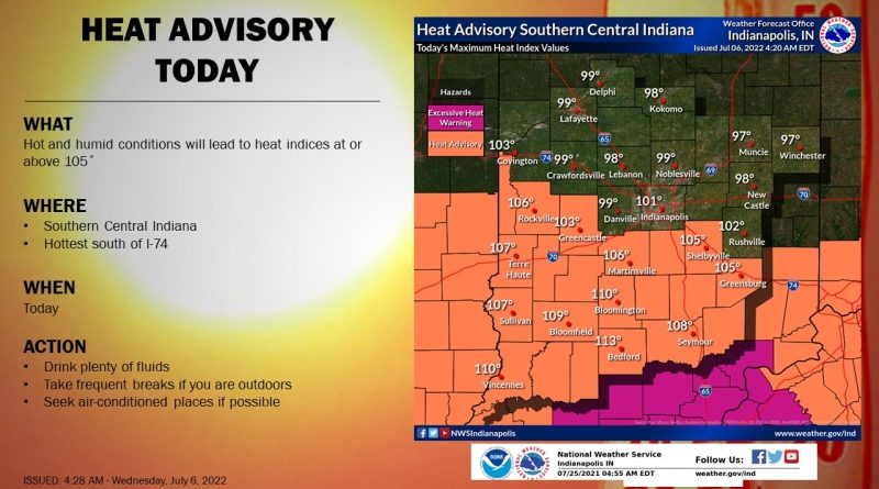
Extreme heat continues today with storms possible
A heat advisory remains in effect for our area until 9 p.m. this evening, with heat index values of more than 110 in some parts of south central Indiana.
The National Weather Service in Indianapolis is forecasting temperatures in the mid 90s and high humidity combining for heat index values of up to 105 in Shelbyville and Greensburg, 108 in Seymour, 110 in Bloomington and 113 in Bedford.
Forecasters say the dangerous heat could continue into Thursday.
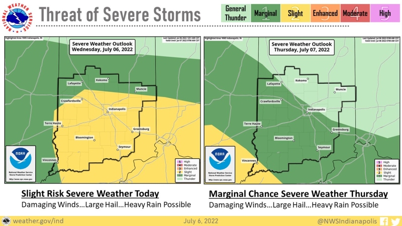
There is also a chance for severe thunderstorms today and tomorrow. The weather service has most of central and southern Indiana under a slight risk of severe weather, with the possibility of damaging winds, large hail and heavy rain.