
Windy day expected with severe storms possible
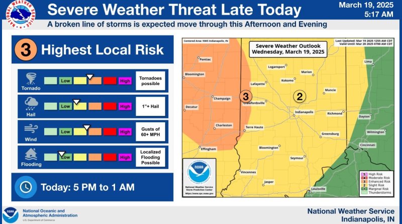
Forecasters say that our area is under a slight risk for severe weather today and it could get windy this afternoon and evening.
According to the National Weather Service in Indianapolis, we could see strong winds with gusts of up to 60 mph. There is also a chance of thunderstorms late today with some possibly severe. Damaging winds could be the biggest threat from the storms with isolated tornadoes possible as the storm system moves through the state .
A wind advisory goes into effect in our area from 11 a.m. to 8 p.m. today.
Emergency officials say that you should make sure you have multiple ways to receive weather warnings and warn that tornado sirens are meant to be heard outdoors and may not be audible in a building. You should also make sure you know a safe space to go in your home or at work if severe weather hits.
A flood warning on East Fork White River at Seymour has been allowed to expire after the river dropped back below the flood level overnight. According to river gauges, the river is now at about 11 and a half feet, which is six inches below the minor flood stage. The river crested yesterday afternoon and dropped below the 12 foot flood level by about 2 a.m. this morning. The flood warning was originally set to expire this afternoon.