
Hurricane remnants to bring heavy rain to area today, tonight
Forecasters say the remnants of Hurricane Beryl are going to be passing through our area this afternoon and evening, bringing storms with heavy rain and the threat of more severe weather.
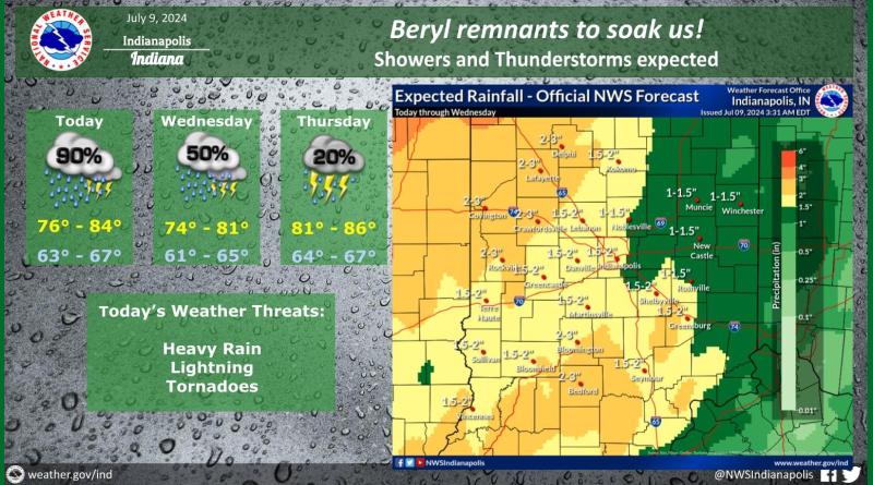
According to the National Weather Service in Indianapolis, the storms will bring a threat of short-lived tornadoes with the greatest chances from 6 this evening until 2 a.m. Wednesday morning. All of southern Indiana, south of Interstate 70 is in the threatened area and forecasters say that there is a 5 to 9 percent chance of tornadoes.
There is a 90 percent chance of rain today with an inch and a half to two inches throughout most our area. However a wedge shaped area including most of Brown and western Jackson along with southern Monroe and Washington counties could see up to 3 inches of rain — the heaviest rain expected in the state.