
Forecasters see chance for more severe storms late today
We could see some more severe weather this afternoon.
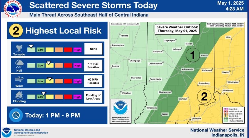
The National Weather Service puts much of southeastern Indiana under a slight risk for bad weather, following a diagonal line roughly from Seymour to Greensburg.
A cold front is expected to move through the area this afternoon bringing bad weather with it. We could see numerous thunderstorms this evening which could turn strong to severe. That could include hail of up to an inch, 60 mph winds and heavy rains bring flooding to low-lying areas. The greatest danger today will be from 1 p.m. this afternoon through 9 p.m. this evening.
Tornadoes are not expected with this storm.
Looking to the weekend, more thunderstorms are forecast for Friday and Saturday.