
Extreme heat continues with 100+ heat index today
Our area continues to be under a risk of extreme heat according to forecasters, who are using a new classification tool.
According to the National Weather Service, although temperatures are expected to reach 93 today, the humidity is going to make it feel like 102. A heat advisory remains in effect through Friday evening.
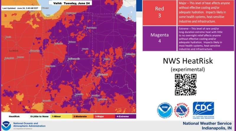
The National Weather Service is testing a new alert system for heat risks. The HeatRisk tool flags hot conditions that are unusually warm for the time of year and factors in humidity. It works on a five point scale with numbers and colors. Zero or green shows little to no risk from expected heat, one or yellow shows minor risk, two or orange shows moderate risk, three or red shows major risk, and four or magenta shows extreme heat.
The weather service says that this week’s weather is ranked as the highest level, or a Magenta Extreme Heat Risk event because of the long duration of high heat, with little or no overnight relief. Anyone without effective cooling or sufficient hydration is in danger. The high heat is expected to affect local health systems, heat-sensitive industries and infrastructure.
TTWN Media Networks contributed to this report