
Friday night tornado rated as EF-2 in initial damage surveys
The National Weather Service says that a tornado that tore a just over 35 mile path through Monroe, Brown and Bartholomew counties Friday night was, at its peak, an EF-2 with wind speeds of up to 128 mph that was 350 yards wide.
The National Weather Service has issued its initial reports on Friday night’s severe weather, saying that the tornado through our area was on the ground for almost 45 minutes. It started nine miles southwest of Ellettsville at 7:27 p.m. and ended just east of Grand View Lake at 8:11 p.m., seven miles southwest of Columbus.
Although the tornado was on the ground much of the time, the survey team found that most of its path moved through dense, wooded areas. Starting off as an EF-0 in Monroe County, it strengthened to an EF-2 by the time it hit Brown County State Park including the Horseman’s Campground where several campers were staying. The Brown County Volunteer Fire Department reports three people were injured at the camp. They were either treated by medics at the scene or took themselves to the hospital.
By the time the tornado reached Mount Liberty Road, it had gone back to an EF-0 or EF-1.
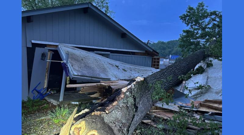
In Bartholomew County the tornado path was 100 to 200 yards wide, causing substantial tree damage and some EF-0 and EF-1 damage to buildings. It ended just east of Grandview Lake.
The National Weather Service says a total of four tornadoes have been confirmed to have hit Indiana Friday night. One person was killed by an EF-2 tornado that swept through Greene County and three others were injured. An EF-0 twister touched down briefly in Putnam County and a tornado started in Illinois as an EF-1 and ended in Sullivan County, Indiana as an EF-0.
Photo courtesy of Bartholomew County Sheriff’s Department.